Our campsite across from Thunder Point
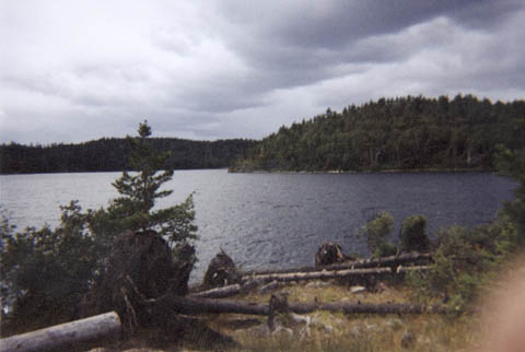
We finally found a campsite just in the South Arm of the Knife Lake on a bluff across from Thunder Point. The windstorm from July 4, 1999 really started to show its effects here. As big as Knife Lake is, a west wind could roar across the lake. With not much shelter, there were tons of uprooted trees. Our canoe is beached to the left of the picture here. It was a fairly steep climb up to the site.
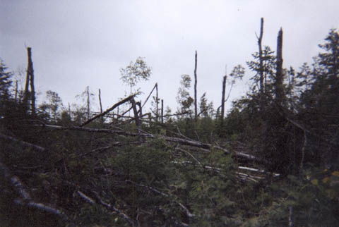
This picture, taken on the path to the latrine, showed that it probably wasn't very fun to be relieving yourself at noon on the day of the windstorm. Since it was very high profile, the trees on this bluff took the brunt of the wind, and not too many were left. I know I wouldn't have wanted to be dodging falling trees while going to the bathroom! It was kinda difficult to find a suitable tree to hang our food from to discourage bears from visiting our camp. We eventually hung it over a tree that had snapped off high enough to give us a decent place to hang the bag.
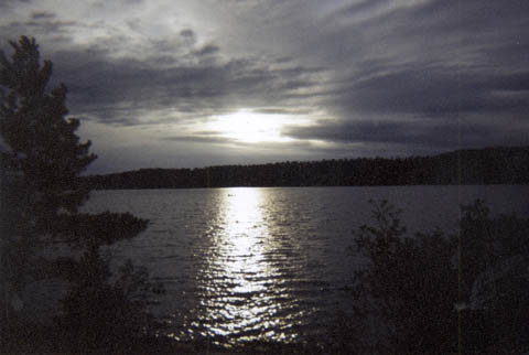
This is an awesome picture of a canoeist out fishing near sunset. He's right in the middle of the sun glint off the lake. That's Canadian soil (Quetico Provincial Park - equivalent to the BWCAW) across the lake. I'm looking west-northwest in this picture.
Just click the 'Back' button on your browser to return to the map you were looking at.